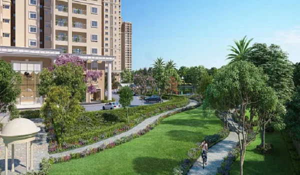
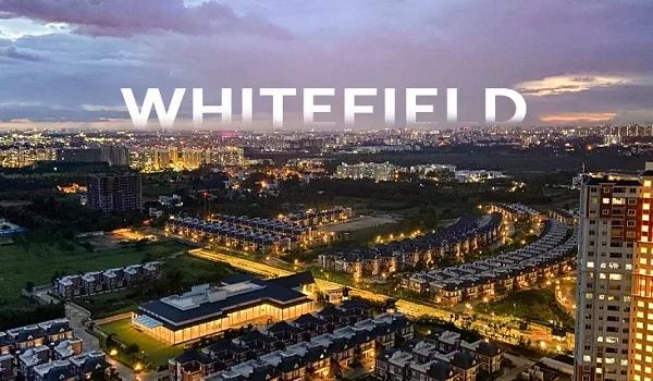
Prestige Oakville Location

Prestige Oakville's location is Whitefield, Varthur Rd, Bangalore, Karnataka, 560066. The project is surrounded by major IT hubs such as ITPL (or ITPB), H M Tech Park, and Mind Comp Tech Park. The project is also close to top educational institutions, healthcare facilities, and entertainment zones.
Prestige Oakville Address

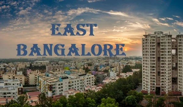
The address of Prestige Oakville is on Varthur Main Road, Whitefield, Bangalore. Bangalore's suburbs are great for first-time real estate investors. The city's tech parks and many multinational companies provide jobs for millions of people. This has caused a population boom, which has greatly impacted the housing market.
Prestige Oakville Connectivity

In the real estate industry, connectivity is everything. It affects the long-term value and performance of residential and commercial projects. Investors and developers understand the importance of choosing sites with quick market access, a trained labour force, and necessary services.
The project is located in a well-known neighbourhood with well-maintained roads, an international airport, and other conveniences that make it easier to get to important city job centres and other sections. The region is well-served by transportation options, including the airport, metro, trains, and roadways.
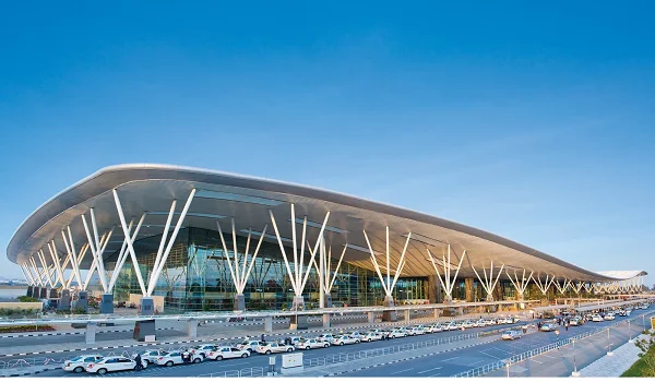
Air Connectivity

Bellary Road, NH 44, and the Outer Ring Road provide easy access to Kempegowda International Airport from the project's location. It ensures quick and simple transportation to and from the project and the airport.
- Kempegowda International Airport – 40 km
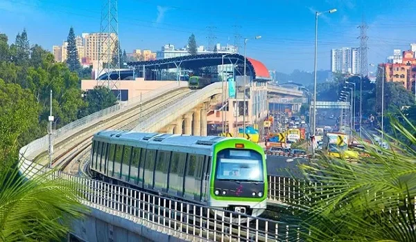
Metro Connectivity

The Bengaluru Metro Rail Corporation Limited (BMRCL) was established in 2008, and Namma Metro, the city's rapid transit system, has been in service since 2011. There are currently two operable lines covering a total of 42.3 km: the purple line runs east-west, and the green line runs north-south. In addition, red, blue, and yellow lines will be built to improve the connection between the city airport and the suburbs.
- Purple Line
- Bangalore's first Namma metro line will go into service.
- Began as part of the first phase of the Bangalore metro network, which contains 37 stations and 4 interchanges.
- It is the city's first underground metro station
- Connects Whitefield and Challaghatta over a distance of 42.7 km.
- Green line
- The second operational line on Bangalore metro routes
- Covering a distance of 31 km and 29 stations.
- Ties Nagasandra in the north and the Silk Institute in the south together.
- Yellow Line
- The 18.82 km (11.69 mi) stretch is entirely at an elevation.
- Connecting Bommasandra and R.V. Road with 16 stations
- Enabling interchange possibilities with the Blue Line at Silkboard, the Pink Line at Jayadeva Hospital, and the Green Line at R.V. Road.
- Blue line
- An 18.236 km elevated metro route
- Connects Central Silkboard and K.R. Puram
- Comprising 13 stations
- Some of the well-known areas are HSR Layout, Bellandur, and Mahadevpura.
- The current Baiyappanahalli Depot will serve as the train's stable and maintenance location.
- The first metro station in Bangalore connects Kasturi Nagar to the airport.
- Pink Line
- Constructed with a planned length of 21.386 km,
- MG Road, Cantonment, IIM-Bangalore, and other well-known locations are among the eighteen stations proposed along the route.
- It is intended to combine elevated (7.501 km) and underground (13.885 km) tracks.
- Eighteen stations are planned, covering several well-known areas like MG Road, Cantonment, and IIM-Bangalore.
- The Pink Line depot is expected to be at Kothanur, spanning 31.5 acres.
- It will link Gottigerre, south of Namma Bangalore, with Nagawara.
- Orange line
- Formally referred to as the ORR-West Line, this is a proposed route.
- A portion of Namma Metro's Phase 3A is anticipated to be operational by 2028 or 29.
- There are 22 planned stations along an elevated line.
- It would travel 31 km along the Outer Ring Road (ORR) from JP Nagar to Hebbal. At Hebbal, the line would interchange with the Blue Line.
Train Connectivity

The primary railway station serving the Indian city of Bangalore is called Bangalore City Railway Station, officially Krantivira Sangolli Rayanna Bengaluru Station. It is also called KSR Bengaluru Station, Bengaluru City Railway Station, or Majestic Railway Station. The city's local train network will benefit Prestige Oakville residents in Bangalore, as it is the busiest railway station in the South- western zone of Indian Railways.
The Bengaluru Suburban Train Project (BSRP), a 149.348 km2 network of commuter trains with 64 stops, is being built in Bangalore, Karnataka. Rail Infrastructure Development Company (Karnataka) Limited (K-RIDE) is implementing the BSRP, which is expected to be finished in 2026.
- Corridor 1: Sampige Line
- Route: KSR Bengaluru – Yelahanka – Devanahalli
- Length: 41.478 km
- Depot: Akkupet Depot
- Number of Stations: 15 (8 elevated & 7 at-grade)
- Corridor 2: Mallige Line
- Route: Baiyyappanahalli Terminal – Chikkabanavara
- Length: 24.866 km
- Depot: Jalahalli Depot
- Number of Stations: 14 (6 elevated & 8 at-grade)
- Corridor 3: Parijaata Line
- Route: Kengeri – Whitefield
- Length: 35.52 km
- Number of Stations: 14 (4 elevated & 10 at-grade)
- Corridor 4: Kanaka Line
- Route: Heelalige – Rajankunte
- Length: 46.285 km
- Depot: Silkboard Depot
- Number of Stations: 19 (4 elevated & 15 at-grade)
Road Connectivity

Prestige Oakville residents have easy access to all city districts as well as multiple state and federal highways. Bangalore City is accessible thanks to its vast road network and transport system. The principal mode of transportation in Bengaluru is the Bengaluru Metropolitan Transport Corporation (BMTC), with the main bus terminals being Majestic Bus Station, K.R.Market, and Satellite Bus Station. The Karnataka State Road Transport Corporation (KSRTC) facilitates intercity travel between different regions of Karnataka and its bordering states.
The road network of Bangalore is made up of ring, arterial, sub-arterial, and residential streets and spans more than 3,000 km (1,800 mi). Most of the city's radial road network converges near the centre. Bangalore's principal thoroughfares leading into the city consist of
- Bellary Road in the north
- Tumkur Road and Mysore Road in the west
- Kanakpura Road, Bannerghatta Road and Hosur Road in the South
- Airport Road and Old Madras Road in the east
Places to visit near Prestige Oakville Bangalore
Pancha Linga Nageshwar Temple

The temple is 1,300 years old. The Nageshvarasvami and Nageshvara shrines, located within the temple complex, were established under the rulers of the Western Ganga dynasty, Nitimarga I and Ereyappa Nitimarga II.
The shrines that are still standing are said to be a remnant of the Chola, Hoysala, and Vijayanagara dynasties' dominion over the area. The epigraphist R. Narasimhachar found an Old Kannada inscription in this temple complex that dates to around 890 and relates to a battle in Bangalore, now Bangalore.
Lalbagh Botanical Garden

Located in the centre of Bangalore, Karnataka, Lalbagh Botanical Garden is a 240-acre floral wonderland rich in history. The garden, created in the eighteenth century by Hyder Ali and subsequently restored by his son, Tipu Sultan, features an array of exquisite flowers. Explore historic trees, themed gardens, and the famous Glass House, modelled after London's Crystal Palace. The yearly flower show is held in Lalbagh and draws fans from all across the nation.
Tipu Sultan's Summer Palace

The Summer Palace of Tipu Sultan is a magnificent example of how traditional Islamic and Hindu architectural forms may coexist. The palace features exquisitely carved arches and lovely floral designs. It also has a lovely courtyard with elaborately carved pillars all around it. Murals on the palace walls portray hunting scenes and other events in Tipu Sultan's life. The king met with his subjects and held significant meetings in the palace's exquisite Durbar Hall.
The palace has been turned into a museum and is currently conserved by the Archaeological Survey of India. Tipu Sultan's clothing, personal effects, and sword are among the many artefacts and items kept in the museum. Additionally, the museum features a superb collection of paintings, photos, and other objects that showcase the region's rich cultural heritage.
Bangalore Fort

Mud was the principal building material used in the construction of the Bangalore Fort in 1537. The builder was Kempegowda I, Bangalore's founder and a Vijayanagar Empire vassal. Hyder Ali constructed a stone fort in 1761 to replace the mud one. In the late 18th century, Tipu Sultan, his son, made additional improvements to the fort. Regrettably, in 1791, during an Anglo-Mysore conflict, the fort sustained destruction. It is nevertheless a superb illustration of military fortification from the 18th century.
Dodda Alada Mara

The enormous 400-year-old banyan tree known as Dodda Alada Mara may be found in the Bangalore village of Kethohalli. With pride, Dodda Alada Mara claims to be India's second-largest banyan tree.
The aerial prop roots on this enormous tree have grown into thick, woody trunks that resemble the main trunk, giving it its distinctive appearance.
The Big Banyan Tree has spread laterally across an area of three hectares using these prop roots. After the main trunk died of illness in the 2000s, it currently resembles a forest of trees with prop roots entwined.
Tech parks near Prestige Oakville:

- Prestige Cloud Tech Park
- ITC Factory
- Devanahalli Business Park
- Ecopolis
- North Gate
- IFCI Financial City
- KIADB IT Tech Park
- Shell Technology Centre
- L&T Tech Park
- Bhartiya City
- Kirloskar Business Park
- Manyata Tech Park
- Karle SEZ
Education Institutions near Prestige Oakville:

- NAFL – North Urbana
- Stonehill International School
- Sterling English School
- Vidyashilp School
- Chrysalis High School
- Canadian International School
- Delhi Public School
- Ryan International School
Shopping and entertainment centres near Prestige Oakville:

- Clarks Exotica
- Decathlon
- Signature Club Resorts
- Padukone-Dravid Centre for Sports Excellence
- Forum Mall
- RMZ Mall
- Phoenix Mall of Asia
- New Manasa Hospital
- North Bangalore Hospital
- Akash Multispeciality
- Omega Multispeciality Hospital
- Aster CMI Hospital
- Cytecare Hospital
- Bangalore Baptist Hospital
- Columbia Asia Hospital
Hospitals near Prestige Oakville:

FREQUENTLY ASKED QUESTIONS
1. Where is Prestige Oakville located?
The project is located near Varthur Main Road in Whitefield, East Bangalore, one of the city's most sought-after destinations.
2. Is the project location easily connected to major IT or tech parks?
The project location presents easy connectivity to the city's major employment hubs and tech parks, such as Prestige Tech Park, Manyata Tech Park, Bagmane Tech Park, Ecopolis, etc.
3. How close are the project's basic amenities to the location?
With schools, hospitals, colleges, IT parks, and shopping centres close by, the project's Bangalore location improves the quality of life and gives inhabitants more time for leisure and personal interests.
4. Is there a metro station near the project site?
The project is close to several of the city's main metro stations. The metro makes it simple for locals to go where they're going, cutting down on travel time.
5. Is driving around Bangalore convenient?
Bangalore has excellent access to all of the city's main thoroughfares and secondary highways. It is also linked to Bagalur Main Road, Nagavara, and the Outer Ring Road via intersections.
Disclaimer: Any content mentioned in this website is for information purpose only and Prices are subject to change without notice. This website is just for the purpose of information only and not to be considered as an official website.
|
|